Public Meeting #1 Summary
Orangeburg Loop
Public Meeting Summary
Overview
Two in-person Public Information Meetings (PIMs) were held for the Orangeburg Loop Improvements Project to share information about the proposed project and solicit public feedback. The first Public Information Meeting (PIM) was held on December 9th at Gregg Middle School and the second was held on December 11th at First Baptist Church of Jedburg. Two meetings were conducted to accommodate residents at both ends of the project area. The meetings were conducted drop-in style, without a formal presentation, to provide flexibility and maximize opportunities for attendance. Project representatives were present to engage with attendees and answer any questions.
Upon arrival, attendees were asked to sign in and were provided with a project handout outlining the project purpose, proposed improvements, anticipated schedule, and instructions for submitting comments. Dorchester County staff and project representatives were stationed throughout the meeting room. Five display boards were arranged at stations around the perimeter of the room, highlighting the project’s purpose and need, timeline, existing and future traffic conditions, and typical sections. In addition, roll plots displaying the proposed design were available for review.
Handout Purpose and Need Environmental & Community Resources Project Timeline Traffic Data Typical Sections Roll Plots
98 comments regarding the proposed improvements were collected through multiple platforms for a 30-day comment period ending January 11, 2026. Comments were documented, categorized, and thoroughly reviewed by the project team. Frequently discussed topics are summarized below. Every effort has been made to address comments in the most comprehensive and transparent manner.
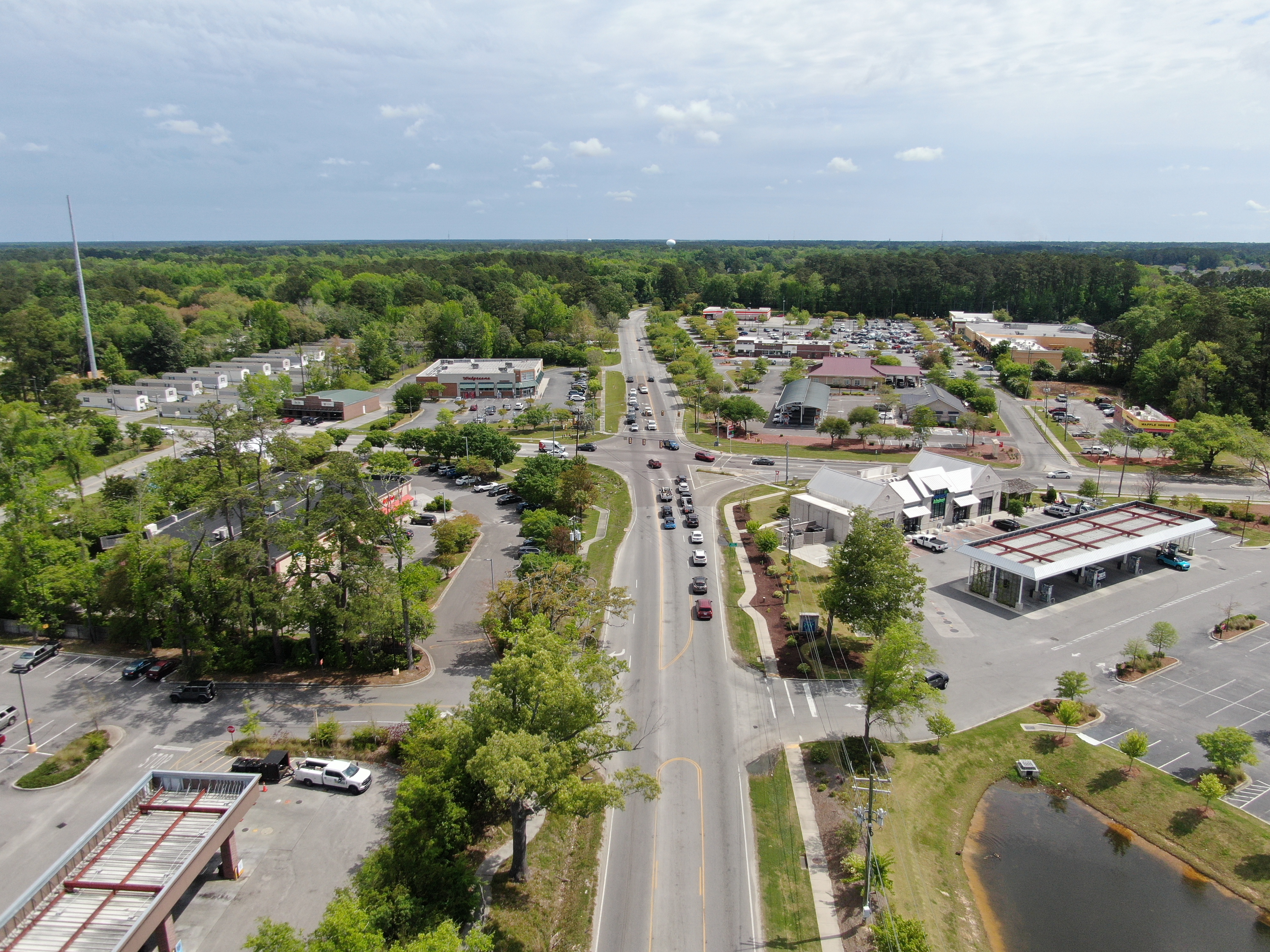
Dorchester County proposes to widen and improve associated intersections on Orangeburg Road from Dorchester Road to Yerby Road, Mallard Road from Orangeburg Road to US 78, and Jedburg Road from US 78 to the Berkeley County Line. The approximate eight miles of roadway is proposed to be widened to two through lanes in each direction with a center turn lane. The project will reduce traffic congestion, improve safety, and accommodate bicyclists and pedestrians.
Summary of Public Comments Received
This section provides a summary of the public comments received during the public comment period that ended on January 11, 2026.
Comment Topics
- Bicycle / Pedestrian Infrastructure
- Right of Way Impacts
- Traffic Signals
- Access Management
- Noise
- Area Growth and Development
- Project Timeline
- Project Extension
- Emergency Services
- Flooding/Drainage
- Safety
- Proposed Laneage
- Project Support
Bicyclist/Pedestrian Infrastructure
Comments regarding the inclusion of sidewalks, shared use paths, and bicycle lanes were mixed. Most comments suggested reducing or eliminating these facilities as unnecessary or to minimize right of way impacts, while other comments expressed need and support for them. The bicycle lanes on Mallard Road and Jedburg Road received some negative feedback. Some participants suggested they be omitted or replaced with a shared use path.
- This project is being designed to align with Dorchester County’s Complete Streets initiative and Berkeley-Charleston-Dorchester Council of Governments’ (BCDCOG’s) Walk+Bike Plan to improve multimodal connectivity and community access and provide safe and efficient transportation options for all.
- Key origin-destination points such as schools, convenience and discount stores, and residential areas will remain a focus for bicycle and pedestrian accommodations.
- Bicycle and pedestrian accommodations will be further evaluated as the design develops.
Additional Resources
- Dorchester County – Complete Streets Ordinance
Right of Way Impacts
-
Comments expressing concern over the potential impact of the project on existing residences and businesses along the project corridor were received. Concerns were raised regarding loss of portions of residents’ yards, particularly along the Red Road corridor. The comments included questions about the right of way acquisition process and payment for acquired areas.
- The design team is continuing to evaluate opportunities to reduce right of way (ROW) impacts and minimize relocations where possible.
- Any ROW acquisition deemed necessary will adhere to SCDOT ROW policies and the Uniform Relocation Assistance & Real Property Acquisition Policies Act (49 CFR Part 24).
- If a property is affected, the owner will be contacted directly by a member of the ROW team during the ROW acquisition phase to discuss the specifics. Property owners are entitled to just compensation through a third-party appraisal and review process in accordance with state and federal laws.
Additional Resources
- SCDOT ROW Guidance
- Uniform Relocation Assistance & Real Property Acquisition Act (1970)
Traffic Signals
Comments included requests for a signal to be included at the Sunburst Lakes entrance, clarification on whether the Orangeburg Road intersection with West Butternut Road will remain a roundabout or be signalized, and suggestions for left turn phasing and traffic signal timing.
- New traffic signals on the corridor require approval by South Carolina Department of Transportation (SCDOT). SCDOT requirements for a new traffic signal are based on traffic volumes, crash history, and distance from existing traffic signals. Intersections that meet these requirements are shown to include new traffic signals in the concept plan. Intersections such as Orangeburg Road and Sunburst Way do not meet SCDOT requirements.
- The proposed widening of Orangeburg Loop is expected to improve turning movements from side streets onto Orangeburg Loop by creating more gaps in traffic and providing a two-way left-turn lane for storage.
- As shown in the concept plans, the West Butternut Road intersection will be converted to a signalized intersection. While the current roundabout has provided much needed congestion relief to date, the traffic analysis shows a traffic signal is warranted to accommodate long term traffic needs at this intersection.
- Project engineers will be examining signal phasing and timing during the detailed design phase.
Additional Resources
- SCDOT Traffic Engineering Guidelines: Traffic Signal Operations
SCDOT - Traffic Signals
Access Management
Comments included requests for concrete medians to be added for safety or removed for ease of access and a few comments regarding different access points along the project.
- For most of the project corridor, the two-way left-turn lane as shown in the concept plans was deemed appropriate for providing access without creating undue turning movement conflicts.
- Intersections with higher turning movement conflicts were evaluated for safety needs.
Additional Resources
- SCDOT Access Management Standards, Manuals and Information
SCDOT - Access Management
Noise
Comments expressed concern over existing traffic noise and potential increases from the proposed widening. Additionally, construction noise concerns were raised especially early morning or late-night work. Requests for noise walls were noted as well.
- A noise analysis will be conducted for the entire corridor in accordance with the SCDOT Traffic Noise Abatement Policy, which implements the Federal Highway Administration (FHWA) Noise Standards (23 CFR Part 772).
- Study findings will be shared with the public, and noise abatement measures will be evaluated for installation where warranted in accordance with SCDOT and FHWA criteria.
Additional Resources
- SCDOT Traffic Noise Abatement Policy (2023)
Area Growth and Development
Two comments requested restrictions in future developments, while another comment noted the importance of the project for economic growth.
- Roadway design traffic projections employed a 2050 project design year to ensure capacity meets long-term growth projections and demand along the corridor.
- SCDOT traffic count data and BCDCOG travel demand modeling were used to produce expected traffic counts, population and household projections, and travel times and patterns to aid in traffic congestion management.
Additional Resources
- SCDOT Traffic Counts
- BCDCOG Data – Travel Demand Modeling
Project Timeline
Comments expressed need for the project to move quickly to provide congestion relief.
- This project is in the preliminary stages of development. Through these public meetings, Dorchester County has engaged the public as early in the project development process as possible. Remaining steps required before construction can begin include environmental studies, detailed design, utility coordination, permitting, ROW acquisitions and bidding.
- The project team is working through these steps as efficiently as possible, and project updates will be shared through the project website.
- Recent clearing work along Orangeburg Road was for a sanitary sewer upgrade, and is unrelated to the Orangeburg Road Improvements Project.
Additional Resources
- Orangeburg Loop Project Schedule
Project Extension
Comments requested the project to be extended along Jedburg Road in Berkeley County as well as further along Orangeburg Road to US 78.
-
The proposed project ties in with a separate Jedburg Road widening project by Berkeley County. The combined projects will provide capacity improvements along the Orangeburg Loop corridor from Dorchester Road to I-26. Design efforts are being coordinated between the two projects.
-
Project limits on Orangeburg Road were identified during development of the Transportation Sales Tax referendum and further refined through traffic studies and alternative analysis.
Emergency Services
Comments expressed concern about present day delays in emergency services along the corridor due to traffic congestion. Public comments also note concern that inadequate roadway capacity could delay emergency response services, especially around the schools present along the corridor.
- Dorchester County will coordinate with local emergency response agencies, such as Summerville Fire and Rescue Stations 5 and 2, to ensure rapid response times are maintained during and after construction.
Flooding/Drainage
Comments noted concern over how the project will impact or address existing flooding and drainage issues along the project corridor. Residents noted existing flooding issues near Mallard Rd and streets parallel to it, as well as private yards and drainage ditches. Requests were made that drainage improvements occur before or simultaneously with road widening.
- The design team will be developing roadway drainage improvements in conjunction with roadway widening. Existing locations of regular flooding and drainage outfalls will be evaluated for improvements as part of this process.
- Potential improvements may include:
- Addition of drainage structures such as drop inlets, catch basins, and outfalls
- Addition of roadway drainage crossings with pipes, box culverts, and/or bridges
- Federal Emergency Management Agency (FEMA) regulated streams have been identified in the project area and will be coordinated with project design.
Safety
Safety related comments include a reported difficulty turning right from Mallard Road to Allspice Drive, need for additional traffic signals to provide safe access, and lighting desired along the corridor for safety.
- Crash locations have been identified and studied as part of the concept design development. Areas will be further evaluated as the design continues.
- Intersections such as Mallard Road at Allspice Drive will be designed to accommodate vehicular turning movements.
Proposed Lane Configuration
Comments for changes to the proposed lane configurations include turn lane revisions, reducing Mallard Road from five lanes to three, and several comments to widen the southern end of the project near Dorchester Road to five lanes like the rest of the project.
- The proposed five-lane section on Mallard Road is planned to provide continuity with the overall Orangeburg Loop in both Dorchester and Berkeley Counties.
- The three-lane section near Dorchester Road was found to provide adequate capacity for this lower volume section while avoiding property impacts that would otherwise occur with a five-lane section.
Project Support
Various comments expressed specific support for the project. Among those comments included:
- “Support this plan 100%”
- “It cannot be built fast enough”
- “Yay! This is much needed.”
- “Thank you for the project. It is much needed.”
- “Proposed plan appears very thorough. Happy with safety measures for pedestrians and cyclists.”
- “I think the proposed layout would be perfect for our area.”
Frequently Asked Questions
General
-
Construction is anticipated to begin in 2030 and take approximately 3 years to complete.
-
Residents and businesses will be notified of major changes, or disruptions through general project communications, public notices, and/or posted signage. Construction phasing and traffic impacts will be shared in advance to help minimize disruption.
- Daytime road closures are not anticipated at major intersections such as Dorchester Road, Berlin G. Myers Parkway, US 17 Alternate, Central Avenue, West Butternut Road, Mallard Road, US 78, and McQueen Boulevard.
- The general project limits were identified during development of the Dorchester County Transportation Sales Tax referendum and further refined through completion of the project-specific traffic study and conceptual design alternatives.
- Widening Orangeburg Road from Yerby Road to US 78 is not included with the project scope and was not identified as a project under the current Sales Tax Program; however, it may be considered for future programs.
Traffic Congestion
- Yes. The traffic analysis shows that based on anticipated traffic volumes from background growth and future developments, the proposed improvements will provide generally acceptable levels of service through design year 2050. The traffic analysis is summarized here: Traffic Data
Intersection Improvements
- Yes. In order to accommodate future traffic volumes, this intersection will be signalized.
- While a traffic signal was not warranted based on the traffic study, turn lane improvements are proposed to address safety and access concerns.
Bicycles and Pedestrians
- This project is being designed to align with Dorchester County’s Complete Streets initiative and Berkely-Charleston-Dorchester Council of Governments’ (BCDCOG’s) Walk+Bike Plan to improve multimodal connectivity and community access to provide safe and efficient transportation options for all.
- Key origin-destination points such as schools, convenience and discount stores, and residential areas will remain a focus for bicycle and pedestrian accommodations.
- Bicycle and pedestrian accommodations will be further evaluated as the design develops.
- No. SUPs are designed for non-motorized users such as pedestrians and bicyclists. ATVs, golf carts, and other motorized vehicles are not permitted.
Safety
-
The proposed speed limit signage along the corridor will match existing conditions. Speed limits range from 35 mph in urbanized sections to 45 mph in more rural sections.
-
Safety improvements include:
- Dedicated turn lanes to reduce rear-end collisions.
- Curb and gutter on the outside, which has a tendency to slow traffic compared to the open shoulder condition that exists today.
- Removing obstructions and providing clear sight lines for turning right and left from side roads.
- The project team will coordinate closely with local emergency services throughout construction to ensure that emergency access is maintained at all times.
- Construction phasing and detours will be planned to minimize disruptions to response times and critical access routes.
Drainage & Flooding
-
The project assesses existing flooding and will address stormwater conveyance within the right-of-way, including new grading to channel offsite surface waters to stormwater inlets or the existing outfalls.
- The proposed stormwater management improvements include an enclosed stormwater system of curb inlets and pipe that will meet SCDOT capacity standards and maintain existing outfall locations.
Environmental
- The County is committed to preserving grand trees and maintaining natural buffers wherever feasible, however some trees and vegetation will need to be removed within the construction limits. Any grand trees removed as part of the roadway construction will be mitigated in accordance with Dorchester County Tree Ordinances.
Utilities
- Right of way negotiations will begin after preliminary plans have been designed and approved. If your property is affected, you will be contacted directly by a member of the ROW team to discuss the specifics.
- Property owners are entitled to just compensation in accordance with state and federal laws.
Right of Way
- In some areas, ROW acquisition will be necessary to accommodate the proposed improvements. The County is committed to minimizing impacts to private property wherever possible.
- A preferred alternative has not yet been selected. Once selected, potential impacts to individual properties will be evaluated and calculated.
- If your property is affected, you will be contacted directly by a member of the ROW team to discuss the specifics.
- Property owners are entitled to just compensation in accordance with state and federal laws.
Other
- The traffic analysis includes projected growth models for the project area to determine the necessary capacity and operation improvements needed to maintain acceptable operations and minimize traffic congestion through the design year of 2050.
- All new developments are required to meet applicable County and State requirements. This includes preparing a traffic impact analysis, and constructing any required traffic mitigation measures, if the proposed development meets established thresholds.